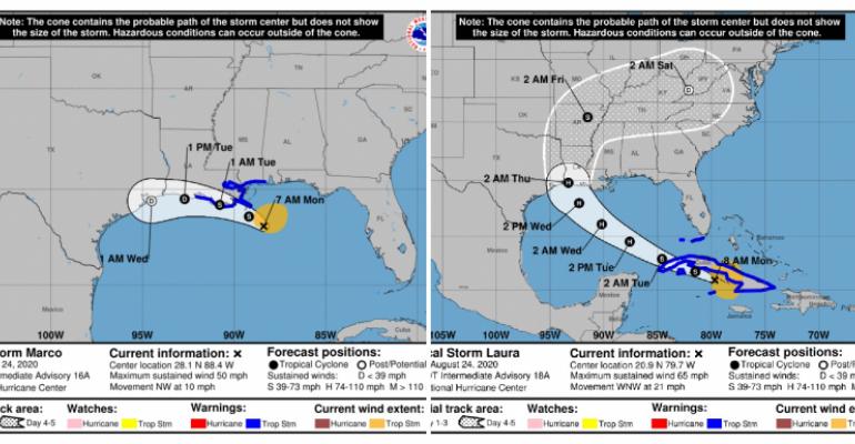
The Port of New Orleans is closed, while the Port of Mobile is at port condition X-ray (gale-force winds expected within 48 hours) and the Port of Galveston remains open with no warnings issued as of Monday morning.
Two Gulf storms a 60-year first
'We haven't seen two storms in the Gulf in about 60 years and they are both expected to make landfall this week as of right now. Our crews are doing everything they can to prepare and are pre-staging response assets to be able respond to emergencies as rapidly and safely as possible once the storms pass,' said US Coast Guard Petty Officer 1st Class Amelia Chutchins, District Eight command center, operations unit controller.
Laura likely to lash Cuba, Jamaica, Lower Florida Keys
Meanwhile, heavy rainfall across much of Cuba and Jamaica is forecast today due to Tropical Storm Laura, with tropical storm conditions expected in the Lower and Middle Florida Keys later Monday. Forecasters at the National Hurricane Center in Miami said Laura could strengthen as it moves across the Gulf of Mexico.
Copyright © 2024. All rights reserved. Seatrade, a trading name of Informa Markets (UK) Limited.
Add Seatrade Cruise News to your Google News feed.  |

